


The short answer: Palm City, FL flood zones come from FEMA maps that took effect February 19, 2020. Palm City is unincorporated Martin County, a Community Rating System Class 5 community, so NFIP policies get 25% off in high-risk zones. Martin County homeowners policies with wind averaged $5,899 a year as of March 31, 2026.
By Jeremy Beckham, REALTOR®, SFR | Last updated: November 21, 2026
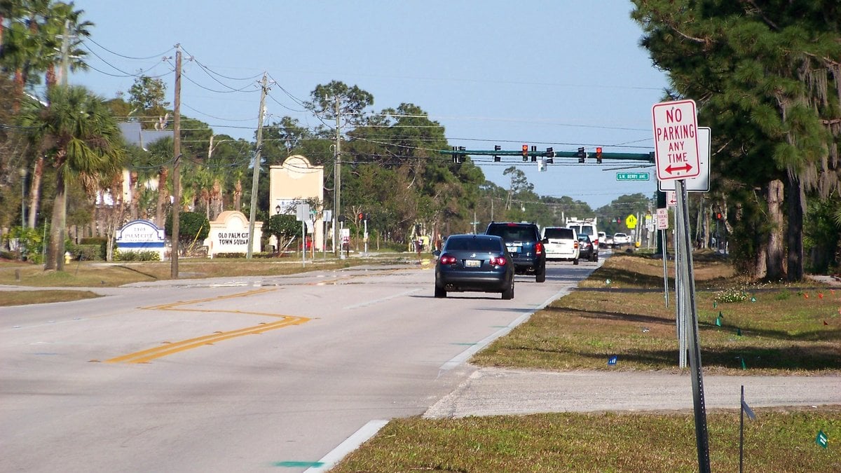
The photo above shows Martin Highway at the Old Palm City Town Square sign.
I’ve been in real estate for 17 years. My Stuart flood zones and home insurance guide, my Port St. Lucie home insurance and flood zones guide and my Jupiter flood zones and home insurance guide cover the Florida-wide rules: NFIP versus private flood, the Citizens flood requirement, roof age, wind mitigation, hurricane deductibles and My Safe Florida Home. This post covers what’s specific to Palm City.
Key takeaways
- Palm City has no city government. It uses Martin County’s FEMA flood maps, effective February 19, 2020, and the County’s Class 5 flood discount.
- Martin County’s September 29, 2026 Repetitive Loss Area Analysis names Old Palm City, Danforth, Woodside, Seagate, Lighthouse and the Palm City Farms area among places with repeat flood claims.
- Martin County’s average homeowners premium with wind was $5,899, compared with $3,491 in St. Lucie County.
Palm City flood and insurance facts at a glance
| Question | Answer (as of November 20, 2026) |
|---|---|
| Who sets flood rules in Palm City | Martin County (Palm City is unincorporated) |
| Current FEMA flood maps | Effective February 19, 2020 |
| Martin County’s first flood insurance rate map | June 15, 1981 |
| Community Rating System class | Class 5 since April 1, 2023: 25% off in high-risk zones, 10% outside them |
| In the Community Rating System since | October 1, 1992 |
| Studied creeks with AE zones | Bessey Creek, Danforth Creek, South Fork of the St. Lucie River |
| Unmitigated repetitive loss properties countywide | 160, in 52 repetitive loss areas |
| Old Palm City North drainage project | Fully funded for design and construction; in design |
| 50% rule look-back | Cumulative improvements over five years |
| Martin County average homeowners premium | $5,899 with wind, $2,471 without (OIR, as of March 31, 2026) |
| Martin County average condo unit owners premium | $1,765 with wind, $887 without |
| Hurricane evacuation zones | AB, CD and E; mobile and manufactured homes count as Zone AB |
| Martin County Floodplain Coordinator | (772) 288-5466 |
| Martin County Emergency Management | (772) 287-1652 |
What flood zones are in Palm City, FL?
Palm City has high-risk A zones, mostly AE along its creeks and the river, and lower-risk X zones farther from the water. Martin County lists A, AE, AH, AO, VE, X and shaded X as its most common zones. The current FEMA maps took effect February 19, 2020, and Martin County says every structure is in a flood zone.
FEMA’s 2020 Flood Insurance Study for Martin County names Palm City’s water sources one by one. It maps detailed AE zones along Bessey Creek, Danforth Creek and the South Fork of the St. Lucie River. It says flood-prone areas in the eastern county have poorly drained soil, a high water table and flat terrain.
Palm City Farms is the big one to know. On its project page for the Palm City Farms Stormwater Master Planning effort, Martin County says a majority of the Farms area falls within the FEMA floodplain.
To look up a parcel, use Martin County’s FEMA Flood Zones Map or the FEMA Flood Map Service Center. My Palm City vs Stuart guide shows how to download an elevation certificate from the County map.
What flood insurance discount does a Palm City home get?
A Palm City home gets unincorporated Martin County’s rating, Class 5. Martin County says that means 25% off NFIP premiums in a Special Flood Hazard Area and 10% outside one. FEMA’s Community Information System lists the County in the Community Rating System since October 1, 1992, with the current class effective April 1, 2023.
The same FEMA list shows no class for the City of Stuart, which my Stuart guide explains. FloodSmart says the community discount applies to all eligible policies regardless of flood zone. Private flood carriers set their own prices.
There’s one exception. Harbour Ridge has a Palm City mailing address but sits in St. Lucie County, as my schools guide explains. FEMA lists unincorporated St. Lucie County at Class 5 too, so the discount matches, but the maps and permits come from St. Lucie County.
One more date matters on older homes. FEMA lists June 15, 1981 as Martin County’s first flood insurance rate map. FloodSmart’s premium page lists a Pre-FIRM discount for primary residences built or improved before December 31, 1974, or before the first map. Most Old Palm City homes, by the County’s description, predate 1981, so ask your agent whether that discount applies. It can’t be combined with the annual increase cap.
Which Palm City areas does Martin County list for repeat flooding?
Martin County’s Repetitive Loss Area Analysis, dated September 29, 2026, maps every area with repeat NFIP claims. Its Palm City sections and its Old Palm City project notes name Old Palm City, Woodside, a Palm City Farms area it calls PC-Farm, Danforth, Conch Cove, Seagate and Lighthouse. Countywide it counts 160 unmitigated repetitive loss properties in 52 areas.
The report describes Old Palm City as a low-lying neighborhood with most homes built on slabs in the 1960s and 1970s. It says Conch Cove and Danforth sit at the end of Danforth Creek where it enters the St. Lucie River. It describes PC-Farm as single-family ranchettes on large lots in an agricultural area, and Woodside as single-family homes built on slabs in the 1980s.
The County says a property lands on FEMA’s list only because it had flood insurance and two or more claims of more than $1,000 within ten years. The areas also include nearby buildings with the same exposure, so a house inside one hasn’t necessarily flooded. It tells you where to ask more questions.
The County mails notices to owners in these areas. It sent a repetitive flooding notice on March 23, 2026, and on August 14, 2026 it wrote to 2,279 owners about the draft analysis. On a Palm City listing, I ask whether the seller received either letter.
What drainage projects is Martin County planning in Palm City?
The largest is the Old Palm City (North) Neighborhood Restoration. The County’s analysis says it is fully funded for design and construction in the five-year capital plan, covering drainage structures, swales, aging utilities, paving and sidewalks. The County’s project list shows it in design.
It covers eight subdivisions: Maplewood, Gull Harbor, Pelican’s Cove, Riverview, Stratford Downs, Woodside, Seagate Harbor and Lighthouse Point. Florida’s 2023-24 Statewide Flooding and Sea Level Rise Resilience Plan lists $3,242,500 for the Old Palm City North Neighborhood Improvements.
The County’s project description says many roadways in the neighborhood are subject to tidal flooding. The analysis says owners will need to make sure structures are elevated to appropriate levels before construction, and that the County will need to match private property to an elevated roadway. If you’re buying a low house there, ask how its floor height compares with the planned road.
Old Palm City also has a separate Integrated Watershed Management Plan. The County has secured money for design and engineering but not construction. The analysis says the County still has to decide whether to protect the neighborhood along the shoreline or hold back high tides at Cornell Road. Pumps may be needed if the answer is a coastal berm.
The Bessey Creek Retrofit targets persistent flooding and standing water after big storms in the Bessey Creek basin, which includes western Palm City and northern Palm City Farms. Martin County’s September 29, 2026 analysis says design is fully funded for replacement of three roadway drainage crossings in Crane Creek and Martin Downs, plus work on an existing county crossing, and that the Board of County Commissioners will prioritize construction funding. The County’s project list, as of November 20, 2026, still shows the Bessey Creek Retrofit as proposed and describes four roadway drainage crossings in Crane Creek.
The Palm City Farms master plan has already produced small fixes, including a berm repair in the western Danforth and Bessey basins, a new culvert in Danforth Creek and swale grading along parts of SW Citrus Blvd.
How do the South Fork and the C-44 canal affect Palm City?
The South Fork of the St. Lucie River takes water from the C-44 canal, also called the St. Lucie Canal, which carries Lake Okeechobee releases. The U.S. Geological Survey says the S-80 structure controls that discharge. The U.S. Army Corps of Engineers runs S-80, about 8 miles southwest of Stuart, and says it passes the 100-year flood.
For a single house, I look at the nearest creek and the tide first. FEMA’s flood study records a historic high-water mark of 7.65 feet on the South Fork in 1995. It records 16.1 feet on Danforth Creek at Leighton Farms Road in 2008. Both figures are in feet NAVD88.
For a creek or river lot, ask the insurance agent to compare the lowest floor on the elevation certificate with the base flood elevation. If the floor sits close to it, budget for flood insurance even if your lender doesn’t require it. The C-23 canal flows to the North Fork, which my Port St. Lucie guide covers.
How does the 50% rule play out on an older Palm City home?
In a high-risk zone, Martin County adds up improvements over five years. If they reach 50% of the structure’s value, the house and its equipment must be raised to at least one foot above base flood elevation. That rule hits hardest on slab homes from the 1960s and 1970s, the era the County describes in Old Palm City.
My Stuart guide explains the rule in full. In Palm City, add one step. If a County project raises the road, your remodel and the road may have to fit together. Call the Floodplain Coordinator at (772) 288-5466 before you price a renovation, and use your inspection period to do it.
Martin County has elevation certificates on record for most homes built after 1991 in a Special Flood Hazard Area. An older home may have none on file. FloodSmart says a land surveyor, engineer or architect can complete one.
What does homeowners insurance cost in Martin County?
Florida’s Office of Insurance Regulation lists a Martin County average of $5,899 a year for homeowners policies with wind, as of March 31, 2026. That compares with $3,491 in St. Lucie County and $6,323 in Palm Beach County. Without wind, Martin averaged $2,471. Your quote will depend on the house.
Condo unit owner policies in Martin County averaged $1,765 with wind and $887 without. OIR, in its July 1, 2026 Property Insurance Stability Report, says actual premiums vary by company, insured value, deductibles and policy terms.
Those are countywide averages. The roof, the wind mitigation report and the deductible move a Palm City quote the same way they do in Stuart. For the tax side of the same house, see my Palm City property taxes guide.
Which hurricane evacuation zone is a Palm City home in?
Check Martin County’s Storm Surge Evacuation Zones page, not the flood map. The County’s zones are AB, CD and E, and some areas are in no zone. Zone AB covers low-lying coastal areas likely to see surge of up to 6 feet. The zones move inland as elevation rises.
A few County rules matter for Palm City. Evacuation orders include residents beside tidal water and in low-lying areas, even outside a zone. The County’s Road to Readiness Guide counts every mobile and manufactured home as Zone AB, wherever it sits. The guide also lists Kanner Highway and Martin Highway among the County’s major evacuation routes. Questions go to Martin County Emergency Management at (772) 287-1652.
My take on Palm City flood zones and insurance
Palm City’s flood discount is the same 25% everywhere in town, so that isn’t where houses differ. What differs is which creek or canal the lot drains to, the age and floor height of the house, and whether the County has a road or drainage project planned for the street. I want those answered in the first week of a contract.
See my Palm City area guide, the Martin County area guide, my Palm City schools guide, my Palm City seller prep guide and my Martin County Amendment 3 guide. To browse listings, use my Palm City homes for sale on Connect or the Martin County home search.
Frequently asked questions
Does the 25% flood discount apply everywhere in Palm City?
Yes. FEMA’s Community Information System lists unincorporated Martin County at Community Rating System Class 5, which Martin County says means 25% off NFIP premiums in high-risk zones and 10% outside them. Harbour Ridge, which sits in St. Lucie County, is Class 5 too. Private flood policies set their own prices.
What is the Old Palm City North Neighborhood Restoration project?
It is a Martin County drainage and road project covering eight subdivisions, including Woodside, Seagate Harbor and Lighthouse Point. The County says it is fully funded for design and construction and includes new drainage structures, regraded swales, utilities, paving and sidewalks. The project list shows it in design as of November 20, 2026.
Is Palm City Farms in a flood zone?
Much of it is. Martin County says a majority of the Palm City Farms area falls within the FEMA floodplain, and the County is developing a stormwater master plan for the area. Every parcel differs, so look up the exact address on the County’s FEMA Flood Zones Map before you make an offer.
How can I tell if a Palm City home is in a repetitive loss area?
Start with Martin County’s Repetitive Loss Area Analysis dated September 29, 2026, which lists the Palm City areas by name. Then ask the seller whether they received the County’s repetitive flooding notice. You can also call the Martin County Floodplain Coordinator at (772) 288-5466 with the address.
How much is homeowners insurance in Martin County on average?
Florida’s Office of Insurance Regulation lists $5,899 a year for Martin County homeowners policies with wind coverage, as of March 31, 2026, in its July 1, 2026 stability report. Policies without wind averaged $2,471. Those are countywide averages, and OIR says actual premiums vary by company, insured value, deductibles and policy terms.
When did Martin County get its first flood insurance rate map?
FEMA’s Community Information System lists June 15, 1981 as the first flood insurance rate map for unincorporated Martin County, which includes Palm City. FloodSmart lists a Pre-FIRM discount for primary residences built or improved before December 31, 1974, or before that first map. Ask your agent if an older Palm City home qualifies.
Thinking about buying or selling in Palm City?
Send me the address and I’ll help you line up the flood zone, the elevation certificate, the repetitive loss question and any County project on the street before you make an offer or set a price. Call or text me at 772.475.5371, or reach me through my contact page.
About the author
Jeremy Beckham, REALTOR®/SFR with NextHome Treasure Coast, has spent 17 years helping buyers and sellers from Fort Pierce through Martin County and south through Palm Beach County to Boca Raton. His office is at 414 S Colorado Ave in Stuart. See how I source my numbers.
This post is general information, not legal, insurance or financial advice. Flood maps, community ratings, project budgets and schedules, insurance rules and evacuation plans change. Confirm details with Martin County, FEMA, your insurance agent and your own advisor.
Sources
- Martin County, Flood Protection (common zones, everyone lives in a flood zone, Class 5 with 25% and 10%, five-year 50% rule, one foot above base flood elevation, elevation certificates for most homes built after 1991, February 19, 2020 maps, (772) 288-5466) and FEMA Flood Zones Map
- Martin County, Repetitive Loss Area Analysis, September 29, 2026 (CRS entry October 1992, 160 unmitigated properties, 52 areas, Palm City area descriptions, March 23 and August 14, 2026 notices, Old Palm City North restoration, Old Palm City watershed plan, Bessey Creek Retrofit)
- Martin County, Capital project list for District 5 (owl.martin.fl.us, read November 20, 2026: Old Palm City North Neighborhood Restoration subdivisions and status, Bessey Creek Retrofit status, Palm City Farms Stormwater Master Planning and completed fixes)
- Florida Department of Environmental Protection, 2023-24 Statewide Flooding and Sea Level Rise Resilience Plan (Old Palm City North Neighborhood Improvements, $3,242,500)
- FEMA, Flood Insurance Study for Martin County, Volume 1, revised February 19, 2020 (Bessey Creek, Danforth Creek and South Fork AE studies, principal flood problems, historic high-water marks of 7.65 feet in 1995 and 16.1 feet in 2008)
- FEMA, Community Information System, Florida community status report, retrieved November 20, 2026 (Martin County CID 120161: first FIRM June 15, 1981, CRS entry October 1, 1992, Class 5, 25%, effective April 1, 2023, maps February 19, 2020; City of Stuart no class). Map lookup: FEMA Flood Map Service Center
- FloodSmart, Premiums and Costs (CRS discount regardless of flood zone, Pre-FIRM discount) and Elevation Certificates
- U.S. Geological Survey, Hydrologic Data Summary for the St. Lucie River Estuary, Open-File Report 2004-1265 (C-44 discharge to the South Fork through S-80; C-23 to the North Fork)
- U.S. Army Corps of Engineers, S-80 structure description (about 8 miles southwest of Stuart, passes the 100-year flood)
- Martin County Emergency Management, Storm Surge Evacuation Zones (AB, CD and E, who should evacuate, (772) 287-1652) and Road to Readiness Guide (mobile and manufactured homes as Zone AB, evacuation routes, shelters)
- Florida Office of Insurance Regulation, Property Insurance Stability Report, July 1, 2026 (Martin, St. Lucie and Palm Beach County average premiums as of March 31, 2026)
Featured photo: “Martin Highway – panoramio.jpg” by Idawriter, from Wikimedia Commons, licensed under CC BY-SA 3.0. Cropped and resized.