


The short answer: Palm Beach Gardens flood zones come from FEMA maps that took effect December 20, 2024, and FEMA lists AE, AH, AO and X zones in the City. The City is Community Rating System Class 10, so NFIP policies there get no CRS discount. Homes in unincorporated Palm Beach County fall under the County’s Class 5, worth 25% off.
By Jeremy Beckham, REALTOR®, SFR | Last updated: November 21, 2026
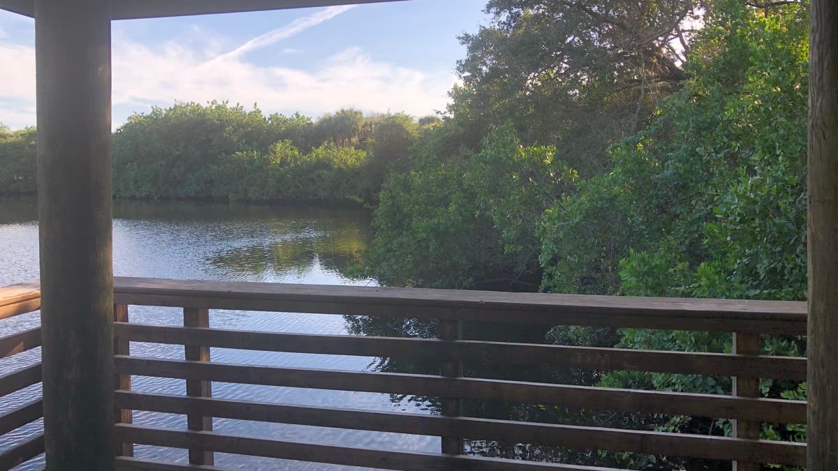
The photo above is the view from a covered overlook at Frenchman’s Forest Natural Area, a 172-acre Palm Beach County preserve on Prosperity Farms Road in Palm Beach Gardens. The County says its wet, low-lying ground was once part of the headwaters of Lake Worth Creek.
I’ve been in real estate for 17 years. My Stuart, Port St. Lucie and Palm City flood guides cover the Florida-wide rules: NFIP versus private flood, Citizens, roof age, wind mitigation and deductibles. My Jupiter and Boca Raton flood guides cover evacuation zones and the 2024 map change. This post covers what’s different in Palm Beach Gardens.
Key takeaways
- FEMA’s current list puts the City of Palm Beach Gardens at Community Rating System Class 10, with no NFIP discount. It has been Class 10 since May 1, 2014.
- Unincorporated Palm Beach County, North Palm Beach, Jupiter and West Palm Beach are Class 5 (25%).
- FEMA’s flood study shows two non-accredited levee systems along the C-18 Canal inside the City.
- Many Gardens communities drain through Northern Palm Beach County Improvement District lakes, gates and pump stations.
Palm Beach Gardens flood and insurance facts at a glance
| Question | Answer (as of November 21, 2026) |
|---|---|
| Current FEMA flood maps | Effective December 20, 2024, for the City and unincorporated Palm Beach County |
| Flood zones FEMA lists in the City | AE, AH, AO and X (no VE coastal zone) |
| City of Palm Beach Gardens CRS class | Class 10, no discount; in the CRS since October 1, 2003; Class 10 effective May 1, 2014 |
| Unincorporated Palm Beach County | Class 5 (25%) |
| North Palm Beach, Jupiter, West Palm Beach | Class 5 (25%) each |
| Juno Beach, Lake Park, Tequesta | Class 6 (20%) each |
| City’s first flood insurance rate map | January 3, 1979 (County: February 1, 1979) |
| NFIP policies in the City | 4,711, with 307 losses and $1,500,704.43 paid since 1978 (as of October 1, 2023) |
| Levee notes on the City’s flood map | Two non-accredited levee systems on the C-18 Canal, owned by the South Florida Water Management District |
| City Building Division | 561-799-4210 |
| Northern Palm Beach County Improvement District | 561-624-7830 |
| Average homeowners premium with wind | Palm Beach County $6,323 (OIR, as of March 31, 2026) |
| Average condo unit owners premium with wind | Palm Beach County $2,311 |
What flood zones are in Palm Beach Gardens?
FEMA’s December 20, 2024 Flood Insurance Study lists four zone types in the City: AE, AH, AO and X. There’s no VE zone, the high-velocity coastal zone mapped in Jupiter, Juno Beach and North Palm Beach. AE zones show a base flood elevation, and AH and AO mark shallow flooding of 1 to 3 feet.
In AH it’s usually ponding, and in AO it’s usually sheet flow. X is the moderate-to-minimal zone.
The same study lists Palm Beach Gardens among the communities with Intracoastal Waterway flooding and Zone AH and AO shallow flooding. So there are two kinds of risk: the Intracoastal near the water, and rain that sits on flat ground until lakes and canals can take it.
The City’s FEMA Flood Maps page says the new maps could put some residents in higher-risk zones, and it sends you to the FEMA Flood Map Service Center and Palm Beach County’s flood zone site. The County’s Update on Flood Zones page says more than 16,000 parcels countywide got a base flood elevation increase of one foot or more.
Why does Palm Beach Gardens get no flood insurance discount?
Because the City is Community Rating System Class 10. FEMA’s Community Information System, retrieved November 21, 2026, shows the City entered the CRS on October 1, 2003, and has been Class 10 since May 1, 2014. Class 10 carries no discount, so NFIP policies inside City limits get no CRS price break.
Palm Beach County’s CRS page, with classes as of April 2024, also lists the City at Class 10, 0%. FEMA’s list doesn’t explain why a community has its class, so I won’t guess.
FloodSmart’s premiums page says a CRS discount applies to all eligible policies in a community, regardless of flood zone. That cuts both ways. In a Class 5 community even an X-zone policy gets 25% off. Inside Palm Beach Gardens, an AE-zone policy gets nothing from the CRS. Private flood carriers set their own prices, so get both kinds of quote.
Do unincorporated Gardens addresses and nearby towns get a discount?
Yes, most of them do. FEMA lists unincorporated Palm Beach County at Class 5, worth 25%. North Palm Beach, Jupiter and West Palm Beach are Class 5 too. Juno Beach, Lake Park and Tequesta are Class 6 (20%), and Riviera Beach is Class 8 (10%). That puts the City below every neighbor on that list.
So two similar houses a mile apart can get different NFIP quotes because one is inside City limits. The City’s residency FAQ says residency depends on the incorporated boundary and points you to the Property Appraiser. My Palm Beach Gardens property taxes guide explains what changes on the tax bill, and my schools guide shows how Gardens mailing addresses cross the line.
How much flood coverage and claims history does Palm Beach Gardens have?
Palm Beach County’s 2024 Local Mitigation Strategy lists 4,711 NFIP policies in the City, with 307 losses and $1,500,704.43 paid since 1978, as of October 1, 2023. Next door, North Palm Beach had 3,963 policies, 110 losses and $367,768.76 paid. Unincorporated Palm Beach County had 50,725 policies.
Those totals cover decades, so they say little about one street. They do show that plenty of Gardens owners carry flood coverage without a discount.
Map history matters on older homes. FEMA dates the City’s first flood map to January 3, 1979, and the County’s to February 1, 1979. FloodSmart lists a Pre-FIRM discount for primary residences built or improved before December 31, 1974, or before the first map. On a 1970s house in the original Gardens neighborhoods, ask your insurance agent about it.
Where has Palm Beach Gardens flooded before?
The County’s 2024 mitigation plan names a few events. On March 21, 2009, severe thunderstorms brought significant flooding to the Palm Beach Gardens and North Palm Beach areas. It was worst around Pearl Street and Riverside Drive and along US 1 near PGA Boulevard, where water reached car windows in some cases. Road construction on US 1 made it worse.
The plan also says rain flooding from Hurricane Jeanne, in September 2004, was mostly minor, except locally in Palm Beach Gardens, Jupiter and the western farmlands, where it was more severe. Those are rain events, not storm surge.
A house in Zone X can still have water in the street after a heavy storm. Before an offer, I ask the seller how the street and yard did in the last big rain.
What does the C-18 levee note on the flood map mean?
FEMA’s 2024 flood study lists two non-accredited levee systems along the C-18 Canal inside Palm Beach Gardens, owned by the South Florida Water Management District. They’re shown on map panels 12099C0358F, 12099C0359F and 12099C0500F. A non-accredited levee is shown as giving less than 1% annual chance flood protection.
In plain terms, it hasn’t been shown to meet FEMA’s standard for protection against the 1% annual chance, or 100-year, flood. The study says that when a levee isn’t accredited, the map shows the area it affects as a high-risk flood area or Zone D. For a house near the C-18 on those panels, look for the levee note at the address.
Northern’s fiscal 2027 budget includes painting preserve fencing along the C-18 Canal in its PGA National unit. The City’s comprehensive plan says it will keep pursuing improvements to SFWMD structure S-44, Canal C-17, G-160 and Canal C-18 to better meet its flood control standard.
Who drains a Palm Beach Gardens neighborhood?
Usually three groups. Your HOA runs the neighborhood lakes and pipes. In many Gardens communities, Northern Palm Beach County Improvement District runs the next layer of lakes, canals, gates and pump stations. The South Florida Water Management District runs the big C canals, including the C-17 and C-18.
Northern’s Know the Flow page says streets are designed to hold water for a while until lakes and canals have room. The C-17 is also called the Earman River, per North Palm Beach’s page on District work there.
Northern was created by the Legislature in 1959 and covers about 128 square miles, including parts of Palm Beach Gardens. Its emergency preparedness page says it may lower water levels before a storm, so don’t be surprised if the lake behind a house drops. Its budget lists 12 pump stations, about 50 miles of canal and 370 water bodies.
Gardens communities that are their own Northern units include PGA National (Unit 11), Frenchman’s Creek (Unit 2), Old Marsh (Unit 21), BallenIsles (Unit 31), Mirasol (Unit 43) and Eastpointe (Unit 14). Northern’s units list has the facility map for each.
Northern’s fiscal 2027 budget includes $750,000 for culvert inspections, cleaning and repairs in Mirasol, $250,000 to line two 60-inch pipes in Old Marsh, and $100,000 for berm repairs in PGA National.
Two points for buyers. Northern’s easements page says owners must keep water management easements clear of fences, trees and structures unless permitted. Its permit page says a seawall next to a Northern lake needs a Northern permit.
What drainage standard does Palm Beach Gardens set?
The City’s comprehensive plan sets the standard. New development has to keep finished floors above flooding from a 100-year, 3-day storm, or as SFWMD permits. Existing development should have a stormwater system that protects finished floors in a 1-day, 100-year storm. The City coordinates its 2015 Stormwater Management Plan with SFWMD and Northern.
That’s a design target, not a promise. The finished-floor rule for new projects also applies to redevelopment, but a house built decades ago may have been designed to an older rule. If you’re comparing an older house with a newer one, the elevation certificates show the difference in feet.
The City’s Streets and Stormwater page says crews maintain canals, inspect catch basins and are mapping stormwater pipes to set repair priorities for aging systems. For a renovation or an open permit request, start with the Building Division at 561-799-4210.
Does Palm Beach Gardens face storm surge?
Less than the coastal towns. The County’s 2024 mitigation plan groups Palm Beach Gardens with inland communities that become more vulnerable when a storm reaches Category 3. The City’s comprehensive plan sets its Coastal High Hazard Area at the Category 1 surge line from the SLOSH model.
The County’s Know Your Zone page has address lookups for both. An evacuation zone is about storm surge. A flood zone covers risks like poor drainage, sheet flow or coastal tides. My Jupiter guide covers evacuation zones.
What does homeowners insurance cost in Palm Beach County?
The Office of Insurance Regulation’s July 1, 2026 Property Insurance Stability Report lists Palm Beach County homeowners policies with wind at $6,323 a year, as of March 31, 2026. Without wind the average was $3,175. Condo unit owner policies averaged $2,311 with wind and $1,703 without.
Martin County, just north, averaged $5,899 with wind. OIR says actual premiums vary by company, insured value, deductibles and policy terms. Roof, wind mitigation and deductibles work the same as anywhere in Florida, and my Stuart guide covers them. My Palm Beach Gardens buyer guide covers Seacoast water bills and club rules.
My take on Palm Beach Gardens flood zones and insurance
The no-discount rating is the part most buyers don’t expect. In Jupiter, North Palm Beach, West Palm Beach and Boca Raton, the CRS discount is 25%. Inside the City of Palm Beach Gardens, it’s zero. So I confirm City or County first, then the zone, the elevation certificate, the Northern unit and the permit history.
See my Palm Beach Gardens area guide and my Palm Beach County Amendment 3 guide. To browse listings, use my Palm Beach Gardens homes for sale on Connect or the Palm Beach County home search.
Frequently asked questions
Do homes outside Palm Beach Gardens city limits get a bigger flood discount?
Usually, yes. FEMA’s Community Information System, retrieved November 21, 2026, lists unincorporated Palm Beach County at Community Rating System Class 5, worth 25% off NFIP premiums, while the City of Palm Beach Gardens is Class 10 with no discount. A Gardens mailing address alone doesn’t settle it, so check the parcel’s municipality.
What flood zones are on the Palm Beach Gardens flood map?
FEMA’s Flood Insurance Study revised December 20, 2024, lists AE, AH, AO and X zones in the City of Palm Beach Gardens, with no VE coastal zone. AE zones show a base flood elevation, and AH and AO mark shallow flooding of 1 to 3 feet. X is the moderate-to-minimal zone. Check the address on FEMA’s map.
What does a non-accredited levee on the C-18 Canal mean for a Palm Beach Gardens home?
FEMA’s 2024 flood study lists two non-accredited levee systems on the C-18 Canal in the City, owned by the South Florida Water Management District. FEMA shows a non-accredited levee as giving less than 1% annual chance protection, and maps the area it affects as high risk or Zone D. Check panels 12099C0358F, 12099C0359F and 12099C0500F.
Can Northern Palm Beach County Improvement District lower the lake behind my house before a storm?
Yes. Northern says it may lower water levels before expected heavy rain if they are above normal control levels, so you may notice the lake drop before a storm. Its staff monitor water levels around the clock and operate pump stations remotely. Homeowners associations handle many neighborhood drainage systems, so call yours too.
How many flood insurance claims have been paid in Palm Beach Gardens?
Palm Beach County’s 2024 Local Mitigation Strategy lists 307 NFIP losses in the City of Palm Beach Gardens, with $1,500,704.43 paid since 1978, as of October 1, 2023. The same table lists 4,711 NFIP policies in force in the City. Those totals cover the whole City over decades, not any single street or house.
Who maintains the lakes and canals in PGA National and Mirasol?
Northern Palm Beach County Improvement District, which maintains canals, waterways and lakes in its units of development. PGA National is Unit 11 and Mirasol is Unit 43. Northern’s fiscal 2027 budget includes $750,000 for Mirasol culvert work and $100,000 for PGA National berm repairs. HOAs handle many neighborhood drainage systems.
Thinking about buying or selling in Palm Beach Gardens?
Send me the address and I’ll help you confirm City or County, the flood zone, the Northern unit, the elevation certificate and the permit history, and line up insurance quotes before you make an offer or set a price. Call or text me at 772.475.5371, call my office at 561.247.8653, or reach me through my contact page.
About the author
Jeremy Beckham, REALTOR®/SFR with NextHome Treasure Coast, has spent 17 years helping buyers and sellers from Fort Pierce through Martin County and south through Palm Beach County to Boca Raton. His office is at 414 S Colorado Ave in Stuart. See how I source my numbers.
This post is general information, not legal, insurance or financial advice. Flood maps, community ratings, drainage projects, building rules and insurance averages change. Confirm details with the City of Palm Beach Gardens, Palm Beach County, Northern Palm Beach County Improvement District, the South Florida Water Management District, FEMA, your insurance agent and your own advisor.
Sources
- FEMA, Community Information System, Florida community status report, retrieved November 21, 2026 (City of Palm Beach Gardens: CRS entry October 1, 2003, Class 10 effective May 1, 2014, no discount, first FIRM January 3, 1979, current map December 20, 2024; unincorporated Palm Beach County Class 5, 25%, first FIRM February 1, 1979; North Palm Beach, Jupiter and West Palm Beach Class 5; Juno Beach, Lake Park and Tequesta Class 6; Riviera Beach Class 8). Map lookup: FEMA Flood Map Service Center
- FEMA, Flood Insurance Study, Palm Beach County and Incorporated Areas, Volume 1, revised December 20, 2024, study number 12099CV001B (Table 2 flooding sources: Intracoastal Waterway, Zone AH and Zone AO ponding; Table 3 zones for the City: AE, AH, AO, X; Table 8: two non-accredited C-18 Canal levee systems, panels 12099C0358F, 12099C0359F and 12099C0500F, South Florida Water Management District)
- City of Palm Beach Gardens, FEMA Flood Maps (maps effective December 20, 2024), residency FAQ (incorporated boundaries, Property Appraiser), Streets and Stormwater (canal maintenance, catch basins, pipe inspection program) and Building Division (561-799-4210, open permit requests)
- City of Palm Beach Gardens, Comprehensive Plan Infrastructure Element (2015 Stormwater Management Plan with SFWMD and Northern; S-44, C-17, G-160 and C-18; 100-year, 3-day and 1-day, 100-year standards) and Coastal Management Element (Coastal High Hazard Area at Category 1 SLOSH line)
- Palm Beach County, Update on Flood Zones (more than 16,000 parcels with BFE increases of one foot or more), Community Rating System (classes as of April 2024), Know Your Zone, 2024 Local Mitigation Strategy, Appendix J (NFIP policies, losses and payments as of October 1, 2023), 2024 Local Mitigation Strategy, Section 2 (March 21, 2009 and Hurricane Jeanne flooding; inland communities and Category 3) and Frenchman’s Forest Natural Area
- Northern Palm Beach County Improvement District, Know the Flow, What is Northern (created 1959, about 128 square miles), Emergency Preparedness, Units of Development (561-624-7830), Easements on Property, Do You Need a Permit? and Fiscal Year 2027 Final Budget (Mirasol, Old Marsh and PGA National projects; C-18 preserve fencing; pump stations, canals and water bodies)
- Village of North Palm Beach, SFWMD Earman maintenance (Earman River, also known as the C-17 Canal)
- FloodSmart, Premiums and Costs (CRS discount regardless of flood zone, Pre-FIRM discount)
- Florida Office of Insurance Regulation, Property Insurance Stability Report, July 1, 2026 (Palm Beach and Martin County average premiums as of March 31, 2026)
Featured photo: “Frenchman’s Forest Natural Area – 50666290553.jpg” by supercraigtalbert, a covered overlook above the water at Frenchman’s Forest Natural Area in Palm Beach Gardens, taken November 29, 2020, from Wikimedia Commons, licensed under CC BY 2.0. Cropped and resized.
Palm Beach Gardens Flood Zones and Home Insurance: City Limits and Canals